CDT: Grants NM (Mile 536) to Cuba NM (Mile 643)

The snow squalls that scattered a lot of the hikers around Grants were an omen of what we could expect to see going further north. The peaks around Grants all had snow and there was news of up to two feet on trail in Colorado. The locals were all telling me that this was really atypical. We should be well into the melt by now. The melt is now 6 weeks behind schedule. For us thru hikers, the snow was now on all of our minds.

On the morning I was heading out of Grants, I met up with Mouse and Dutchman over breakfast at Denny’s. It was really nice catching up with them.

Having breakfast with Mouse and Dutchman

Their main lesson coming out of the Gila was not to wear Tevas through the 150+ river crossings. I’d show you a picture of Mouse’s feet but children might read this, yikes!!!! The only downside of meeting them was that I didn’t leave my room until almost 10A and I still had to walk the two miles just to get to the trail again. My plan was to summit Mt Taylor (which at 11,301′ is the highest peak in New Mexico and which was covered in snow) at 6-7P after a 24 mile hike with a 4000′ ascent then posthole off the north side for several miles until I could descend enough to find a cozy campsite. No problem, right? Let’s just say, no one else contemplated this crazy plan. The ascent went just as planned. The weather was beautiful and cooperating and the trail was just as Carol and Hugo (local trail angels) described. Their water caches helped keep my pack weight down and I was able to move fast (fast for me anyway).

On road walk to trailhead. New Mexicans love their guns.

As I approached the summit, however, things started to unravel a bit. The winds started picking up until they were almost knocking me over at the summit at 6:30-7:00P and the clouds were building. The cold killed the battery on my phone which was my GPS and the swirling snow obscured the trail making it hard to follow.

Mt Taylor summit. Last picture before my battery died.

From reading the maps previously, I remembered that the exit was off the north side and was able to find what looked like a trail under the drifting snow, get under some cover and put a power pack on my phone/gps to reassure me that I was actually following a real path. Fortunately, due to the cold, the snow was pretty consolidated underneath a thinner cover layer so there was not a lot of postholing and I was able to stay on top of it and make progress.

The snow cover thinned and clouds cleared as the altitude dropped

At about 10,000′, and several more miles of hiking, the snow let up and the snow cover thinned, and I was able to find a nice campsite in the dark.

Campsite for the night.

At 28 miles after a very late start with a 4000′ climb and other stressors, that was a long tough day for me. For dinner, I was just too tired to cook so I ate half a block of cheese, put on all the clothes that I had and fell asleep. If would have been a long night if Vanessa hadn’t sent me my puffy coat in Grants.

The next day the skies were blue and beautiful. The trail consisted of a series of fire roads that were easy to follow and it it was much warmer. The downside was with all the snow melting from previous days, the fire roads had turned into a mud that just built up on your shoes.

As the mud collected on your shoes, you would just get taller and taller and your feet heavier and heavier until you could find a rock to scrape them off ……. then the process would start all over again. I could picture an 8′ tall cow with enormous mud clogs on its hooves. Eventually I just started bushwhacking and avoiding the roads as much as possible.

Over the next few days, the landscape transformed into the beautiful vistas you used to see in the old westerns. I’ve never seen such deep blue skies.

Ponderosa Pine – This is my favorite smell in the world

Pair of male collared lizards

Another male Collared Lizard

Two Forks on the trail taken by Pauline (Mbuzi Mawe)

Sunrise near Cuba, NM

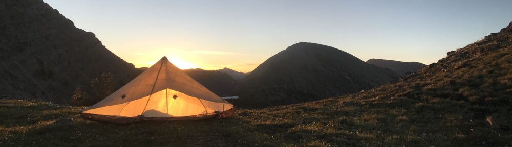
Cowboy camping in the edge of a mesa facing sunrise and under a million stars.

Sunset on the CDT

Wild flowers are all over the desert.

If you can drive there, you’ll find barbed wire & cows

It’s impossible to truly capture the grandeur in pictures.

Pauline, Fred and me at El Bruno’s in Cuba, NM

Over four days, we covered the 107 miles between Grants and Cuba but more memorably experienced some incredibly beautiful remote landscapes few get to see and met some amazing, happy, and adventurous folks like Pauline and Fred whom I hope to keep in touch with well after the trail.

Tomorrow will be our first taste of real snow on the way to Ghost Ranch. The plan is to reach Colorado by next week. Snow is on everyone’s mind.

Posted in CDT

CDT: Pietown NM (Mile 424) to Grants NM (Mile 536)

This next stretch of trail consisted of a whole heck of a lot of road walking. Most folks were choosing to take the alternative route called the Cibola Alternate to get to Grants. Part of this was because the water sources on the official CDT were sketchy and very far apart with such descriptions as “water tastes metallic with a slight urine aftertaste”. Ummm… no thank you. As the Cibola route involved a lot of walking on paved highway, I mixed it up by starting with the Cibola, taking the Narrow Rim Canyon Trail, then back onto the Cibola, crossing the El Malpais, then taking the Bonita-Zuni Alternate into Grants (phew). Still lots of road walking but at least mostly on low traffic dirt forest roads at the cost of a bunch of extra miles. After watching both Smooth and Breakcheck almost get hit (within 2 feet) by some reckless out of lane idiot), I was glad to get away from the traffic.

A truck stopped to chat and gave me a delicious apple. The world is full of kind and generous folks 🙂

Great feed at the TLC Ranch Larry and Charity and their family invite hikers into their home. Such amazing,thoughtful and generous people. This was the most thru hikers they ever hosted at over 20.

Typical fancy ranch sign out of metal.

The toad walk seemed to stretch to the horizon.

This Pueblo House was originally constructed several hundred years ago by the native Americans then was augmented by settlers about 100 years ago.

Stephen was day hiking and gave me a banana. Every day someone gives me Trail magic. It’s incredible how nice folks are.

Eating delicious before mentioned banana

While looking for a place to camp, Southbound and a few other thru hikers accidentally scared up a herd of elk which crossed in front of me.

https://mountain-boy.com/wp-content/uploads/2019/05/img_8168.mov

Morning hike with Breakcheck and Sniffles on the Narrow Rim Canyon Trail

Fresh Mountain Lion tracks. I had been seriously thinking of night hiking this section, phew!

Crossing the El Malpais (The Badlands)

I couldn’t convince anyone to cross the El Malpais (The Badlands) with me. It seems they knew better as you were walking over rough lava rock for 8 miles. It was very rough going especially solo and was constantly having to backtrack as it was very easy to get lost. Many of the cairns had been put up by the ancient Puebloan people hundreds of years ago and the path was not even close to following a straight line. It took 3 1/2 hours to get through along with some help from my ibuprofen bottle. I found out later that most people took even longer. It was beautiful and frustrating at the same time. I was glad that I did it but also glad it was over.

Cactus are beautiful until you get spiked in the toe. Don’t ask…

First working windmill pumping delicious clean water 🙂

The final road walk into town through Dead Cow Canyon

On empty water tank on road walk

Finally made it to the outskirts of Grants NM, yay!!!!!

Grants NM is really spread out and I was not looking forward to the 2-3 miles off trail walk to get to my hotel. Fortunately, Coyote and his dad saw me and had rented a car. More trail magic!!!! They drove me right to my hotel (Super 8 next to the Walmart). Thru hiking has been a reaffirmation for me of how kind and generous people are across this country.

AYCE (All You Can Eat) – They must dread thru hikers

Plate number 5: I have to admit, this was too much even for me. I had to lie down afterwards.

So I decided to take a zero in Grants to give the tendinitis in my ankle a chance to heal up a little. Off to get some more ice. Tomorrow I’m off to climb Mt Taylor which is the highest mountain in New Mexico at over 11,000′. The snows and storms today at only 7000′ had driven a lot of hikers to hitch into town today so the high mountains should be interesting. Tomorrow is 4000′ feet of climbing, high winds forecast, 25+ mile day with a big mountain at the end and a post holing finish in deep snow off the north side of the mountain. Embrace the brutality and welcome to the CDT 🙂

Posted in CDT

CDT: Silver City NM (Mile 162) To Pietown NM (Mile 424)

The last week from Silver City has been pretty eventful. I can’t believe that I’m already half way through New Mexico. I started to string together consecutive 30 mile days and my body is now telling me to slow down and take some time off and heal. It’s so beautiful here though it’s really hard to sit in one place. Maybe I’ll take a zero (0 trail miles) in Grants NM about 100 miles up trail.

From Silver City, Driver and I started on the low route of the Gila Alternate. After about half a day, we descended into the Gila Canyon.

Toad in log next to Gila River

First night in Gila. My Hexamid pitched in foreground.

The Gila was a huge change with its lushness. Such an incredible contrast over the desert from just a couple of days before. It rained down nearly everyday. The trail followed the Gila River and you cross this river something like 150 times if you do the low route like we did.

Driver crossing Gila.

Anther river crossing.

On day 2,we made it to Doc Campbell’s (a little hiker friendly store in the middle of nowhere) where I had a food drop waiting. Driver decided to nero there for the rest of the day while I decided to push on to see the Gila Cliff Dwellings Visitor Center and push on. We met Ant and Rat just as they were leaving. They and most others were taking the faster high route while I decided to continue the low route through the river.

This was the most beautiful part of the Gila. It started with a hot spring. It was actually a bit too hot to do anything but stand in for a few minutes.

Hot spring on Gila just north of Doc Campbell’s.

The Gila low route is one of the most beautiful places I’ve ever been. The river snakes through a beautiful lush canyon and and you have most of it to yourself.

If your not next to the ever, you are walking through open vanilla scented Ponderosa Pine forests.

Ponderosa Pine forest

On the next morning, I made it to Jordan Hot Springs. This is what I’ve always envisioned as a natural hot spring instead of the concrete pool shared with 20 strangers that is typically advertised as”natural hot springs”. It was beautiful and I didn’t want to leave.

Jordan Hot Springs

Two Forks getting all pruny for an hour long soak.

On leaving, I met Armstrong and then went on my way.

The canyon just became more beautiful until we popped out at Snow Lake.

Armstrong crossing Gila

Sunrise on the trail

Snow Lake feeds the Middle Fork of the Gila

As we dried out our gear at the campground at Snow Lake, a storm move in and it started to rain and snow and pelt is with freezing rain. We rushed under the cover of the pot toilets to seek shelter until the storm passed.

On leaving we started the miles and miles of road walking over the wide open mesa. It was during this time we somehow took a wrong turn and went over 5 miles round trip in the wrong direction. This was the first of several 30 mile days.

Snow is unusual this time of year.

Wide open Mesa. Just us, cows, pronghorn, and elk.

Daily yard sale at lunch to dry gear (taken by Gaucho)

The fires came through last year.

Two Forks on the trail.

Sunset on the trail showing good wether for tomorrow.

Yes, that’s a goldfish in the water source. This water clogged everyone’s filters.

Trail magic from Morning Glory’s dad Scott. In addition to a cold brew, he made us grilled cheese sandwiches with fig jam and also gave us homemade mozzarella

Devila Ranch

The route we chose took us past Davila Ranch.

Davila Ranch Main Shelter

John and his daughter build this for CDT hikers and is in the middle of nowhere. You can wash your clothes, use the bathroom, take a hot shower, cook up some eggs, bacon, and meat from his own cows. It’s all supported by voluntary donations. He even has a beer fridge which has a keg in it he had to special order and drive 170 miles each way to get. What an amazing and generous gentleman. I spent most of the day there talking to John and cleaning up after the mob that had just left as we arrived then pushed off for the outskirts of Pietown.

After a beautiful night cowboy camping, I reached the Toaster House in Pietown early in the morning to collect my food drop. Once again there was too much food so I took the opportunity to forward the extra up the trail to Ghost Ranch. Someday I’ll get the food thing right.

Yes those are toasters in front of the Toaster House

The Gathering Place has delicious Pie and you are encouraged to practice responsible gun ownership

Yes, they are serious. We are in New Mexico.

There is not much in Pietown besides the Toaster House which is a hiker hostel, a post office, and a place to get pie. The Gathering Place was open and was filled with thru hikers. Our waiter was packing lead and I found myself saying “Sir” more than normal. Guns seem to make folks extra polite. I had a delicious smothered burrito followed by an entire apple cranberry walnut pie with ice cream all to myself 🙂. After a call to Vanessa, it was time to push on.

Posted in CDT

CDT: Lordsburg NM (Mile 85) to Silver City (Mile 162) Days 5-7

The transition out of Lordsburg is dry, like really dry. No more being coddled by water caches and a now a total reliance on tire tanks and cow ponds.

CDT: Mile 50 to Lordsburg NM (Mile 85) – Days 3 and 4


From Lordsburg, the trail starts with a three mile road walk followed by a crawl under a barbed wire fence. There is a 10′ trail easement with the trail running across a vast parched pasture but the crisscrossing animal paths and lack of consistent trail markers meant that everyone was off trail for good chunks of time.

He didn’t make it to Silver City

Between using your maps and your gps you are usually not totally lost but on the CDT you need to get used to being ok with not being exactly on the trail. There is a certain relief though when you do see that familiar CDT trail marker

The trail to Silver City is a transition out of the dry hot desert with a slow rise in elevation into the first mountains. Many of the folks that I had been hiking with had decided to zero to recover so I started out alone. The open desert is not easy on your body.

I was pretty happy to meet up with Mouse, Dutchman, and Driver at the first watering hole at the 14 mile mark that day which occurred at trail mile 100.

Note toilet bowl float used to refill tank

This was a clean and delicious water source and it was fun filling your bottles as the cows happily slurped up water next to you. As we climbed higher, we started to see more and more trees.

I was surprised at how much I had missed trees, how joyous it was to be on trail, and realized how taxing the desert was on both the mind and the body. As beautiful as it is, people were not not designed for the open desert. Day 5 was 24 miles.

The next day we climbed Big Burro Mountain (8,035′) then dropped down to Burro Mountain Homestead for ice cream, pizza, water, and soda. This was a surprising little hidden piece of paradise.

After dinner with Driver, Mouse, and Dutchman, I pushed on for another couple hours in the dark and I got to watch the crescent moon set. Every time a car drove by on the dirt road though it kicked up a white-out of fine sand in front of my headlamp which settled down after a few minutes and went back to inky black darkness outside the cone of light from my lamp. After a 5-6 miles and past the Tyrone Gold/Copper open pit mine, i found a nice tree on the side of route 90 and cowboy camped under the stars. With an 8000′ Mountain, hiking with friends all day, a belly full of pizza, soda, and ice cream, and 27 miles under my feet, it was a good day.

The next day was a quick 9 mile road walk into Silver City following what looked like the old CDT route before the mine was put into operation. Part of the joy of the CDT is not always following the official route and improvising. This improvisation meant clean clothes and beer before noon. It’s a different view of America when you’re a a slow walking pace along a highway..

Driveway off NM Route 90: clearly this dude is unmarried

I walked into Silver City before 10A (CDT Mile 162). Hard to believe this journey started just over six days ago.

Morning Star Outfitters Silver City NM

In the Little Toad Creek Brewery Silver City (from Dutchman)

Breakfast at The Palace Hotel in Silver City NM with Dutchman, Driver, Mouse, Ocotillo, and Cat Lady.

That night, Mouse and Dutchman invited Driver and me to pile into their nice suite in the Palace Hotel.

Next destination is Doc Campbell’s on the Gila Alternate.

Posted in CDT

CDT: Mile 50 to Lordsburg NM (Mile 85) – Days 3 and 4

The next two days consisted of trying to getting to Lordsburg before the post office closed at noon. The fact was that my pack was way too heavy. I had twice as much food as I needed (thinking I’d only be doing 15 mile days but that’s easy to solve by giving it away) but also had way too much gear. Making the post office on time meant 35 trail miles and another road mile in a day and a half. The trick was the first day was crazy hot and the sun relentless. It was a hard day. Even the cows looked hot. At one point there were even buzzards circling overhead. Seriously!

At dinner, I was bushed but after a rest and little food in my belly felt good again and decided to night hike once again and knocked out another 3 miles without getting too lost. That was more like it and left just 12 miles to knock off the next day before noon and then I could take a half day off to recover.

I made the dash for the post office at 11:15A and forwarded a bunch of gear home, yay!!!

Throughout the day, our hiking posse continued to trickle in to clean up and recover. Many limping and thinking about zeroing in town tomorrow. The desert is not easy on the body. Dinner was a giant delicious salad from the salad bar with a grilled cheese sandwich and loaded baked potato all for $9.18 at Kranberry’s Chatterbox.

In the next 76 mile section to Silver City, we start seeing real mountains and I’ll need to pack light.

Posted in CDT

CDT: Mile 23 to Mile 50

I spent my first night cowboy camping under clear skies on a moonless night. I have never seen so many stars before. The Milky Way stretches out straight overhead in such detail you could clearly pick out the knots of stars, holes from dark dust clouds, and the bulge of stars in Sagittarius that is the center of our galaxy. Before sunrise, there was a beautiful crescent moon next to Venus. It gave me some comfort that Vanessa was probably looking at this same crescent moon on her early morning drive to the gym.

Today I met up with Ant and Rat several times during the day. Their strategy is to locate the best shade and relax there during the hottest parts of the day then make up the hours lost by night hiking when it’s nice and cool. I was kind of skeptical since with all the cow paths crisscrossing the “trail” it is pretty easy to get lost even during the day. So, my strategy that night was to head out after a belly full of dinner and keep going until I tired or became ridiculously lost then camp and straighten out the mess in the morning. Turns out night hiking is brilliant!!! Yes, I did go off trail a lot but when you can’t see very well, you start to use your other senses. Your footsteps sound and feel different when you go off trail and you realize your off trail within a step or two. I was able to squeeze out another five miles in the dark and made it to mile 50 on the second day 🙂

Posted in CDT

CDT: Crazy Cook Monument (Mile 0) to Mile 23

Day 1: Crazy Cook Monument to Trail Mile 23

The first day on trail started at breakfast before sunrise. This and the subsequent 3 hour bumpy truck ride over rough backwoods roads were a chance to get to know some of the other hikers who share this crazy dream. Some would become friends and companions over the next 3000 miles while others would never been seen again.

Thru hikers are an interesting group. Some are retired in their 50’s like Dutchman and Mouse looking for another adventure, many are seasonal workers between jobs and homes or living out of a van, others like Mountain Goat had his house burnt down in Paradise CA and figured what the heck. We are all connected though by a love for being on trail. Many of the experienced hikers are counting every ounce and are carrying tiny packs while others like Shayla brought along her fiddle. Although only about 350 hikers started the CDT this year, there is a very restricted window you can start. Start too early and the snow pack is too deep in the San Juan Mountains. Start too late and you catch the early snows in Montana so most Northbound (NoBo) hikers start between mid April and mid May. This is our hiker bubble.

The trail starts at the US/Mexican border at a place called Crazy Cook where legend has it some crazy cook killed someone and they never caught him. There is a nice farm on the Mexican side of the border but the US side is pretty barren BLM land full of free grazing cattle.

The wall here is more like a barbed wire fence.

The desert here is beautiful in its own way. The Ocotillo was in bloom everywhere.

After pictures at the start, the hikers drifted off one by one. On their journey north. Only 3000 miles to go.

The landscape is mostly flat and barren with no natural water sources. We would be pulling water from caches and tires and solar powered wells that the ranchers let us use.

I was surprised to make 23 miles the first day. The plan was to start with 14. If all you’re doing is walking all day, you can’t just help doing big miles though.

Posted in CDT

CDT: Day 0 to Lordsburg NM

Vanessa waved goodbye to me at 4:30 this morning from the Newburyport MA bus depot. I couldn’t help but have passing thoughts of what the heck am I doing. Leaving my amazing wife and friends and work for this crazy dream? Shouldn’t I be planting my garden now? Shouldn’t I be prepping my kayak for a Spring paddle? Shouldn’t I be working on the house? Shouldn’t I be a good friend and reliable companion to my wife? Am I nuts to trade a comfortable life and a loving family for 5 months for the brutality of the 3000 mile trek along the Rocky Mountains from Mexico to Canada that is the CDT?

Few great dreams are ever accomplished, however, by focusing on why you shouldn’t but rather on why you should. The trail is full of magic. From a Milky Way that stretches from horizon to horizon and with more stars than you can count, to tiny lizards doing push-ups trying to impress you with their size, to meeting folks in a different part of the country and realizing that the world is full of kindness. I met a woman on the bus today that had just been released from prison after 6 months behind bars. After we chatted a while, she insisted that I take her fries and a taco. The world is a surprising and wonderful place if you just keep your eyes open and take that giant leap.

Tonight I’m in Lordsburg New Mexico and tomorrow morning bright and early the adventure begins.

-Two Forks