CDT: Atlantic City WY (Mile 1743) to Pinedale WY (Mile 1828) The Southern Wind River Range

Having camped just a mile outside of Atlantic City WY the night before, I reached town first thing in the morning. Wild Bill met me outside of his B&B and immediately set me up with a little cabin. He and his wife Carmella are two of the nicest folks I’ve ever met. The temp had gone down to 24F the night before so the pipes were frozen to both the washer and the bathroom. This was crazy since it was mid June but it’s been a crazy year. After a hour though, everything was sorted out and Carmella had set me up with some herbal tea in fine china and fresh baked cookies and warm delicious brownies. This was a huge step up from my usual cow pond water and granola bar for second breakfast.

Tea time with Carmella’s fresh baked brownies and cookies at Wild Bill’s

Double Lunch at the Grub Stake in Atlantic City

Marco “Polo” and me enjoying dessert time with Carmella’s fresh baked apple ala mode at Wild Bill’s

Wild Bill was just in the process of putting in a hot tub for the hikers. Darn it! Missed the hot tub by 3 days.

I wasn’t quite sure what my next steps on the trail should be. Basically, I could either keep going north into the Wind River Range and try to push through the snow or bounce north all the way to the CDT northern terminus in Glacier National Park and start heading south. Montana had a nearly normal snow year and most of the snow had cleared out so bouncing up to Glacier and heading south was the sensible way to go. Of course I decided to continue going north through the Winds. This decision actually seemed crazy even to me. No one had made it through yet. Roadrunner had tried just a few days before but 25 miles in he made it to a river that he thought was too dangerous to cross then turned around and came just about all the way back. A horn hunter had also just gone missing in this same area. They later found his drowned body in a log jam. While looking for him using airborne FLIR, all they saw were elk and hungry grizzlies just coming out of hibernation. But some one had to be the first through and I had my bear spray, fancy new snow shoes, and Vanessa had just send me my spikes and ax.

So the plan was to keep going north through the Winds until it got too sketchy or the snow kicked my biscuits. Well, that didn’t take very long.

The next food carry was going to be the longest on the entire CDT at just a bit under 200 miles so I was carrying an enormous load of 10 days of food. That along with all my snow gear was well over the “oh my god, this is really heavy” backpack limit.

The first day was all under the snow line and much of it through beautiful pine forests. There was only patchy snow and it kind of felt like our late spring walks in New Hampshire. Because of the snow melt, water was everywhere and generally didn’t take like cow poop.

The start of the hike went through South Pass City: Population 4

Into the Bridger Wilderness. Do not expect a Wi-Fi signal.

It was the second day when the fun began. As the trail climbed closer to 10,000′, the patches of snow got more and more dense then continuous and then deep. The trail, which is normally hard to follow on the best of days with its lack of markers became nearly impossible to follow covered by deep snow and going through dense woods. The snow itself was a knee to hip deep slushy mess. Although my new snow shoes had plenty of float to stay on top of the snow, the spalling (snow build-up) on the snowshoe’s crampons destroyed any traction they might have had in the steep terrain. It was like having a little red saucer attached to each foot.

Spalling on my snow shoes

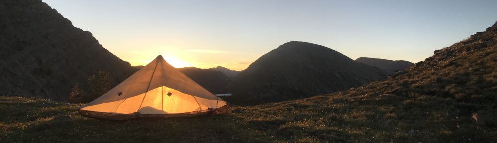
One of the few flatish spots above the snow line

I can’t remember slipping, sliding, falling and making so many snow angels in my life so off came the snow shoes and on went the MICROspikes. The postholing was not much better. Knee to waist high post holing through wet slush down into icy water underneath. It was no longer cold enough at night to freeze more than a thin top crust so I couldn’t play the trick of getting up at 2A and hiking while everything was frozen at night. At some point I realized that there was no way I was going to make it through 60 miles of this (which would start in earnest in a couple days) and that I would need to abandon the Winds for now and do the 60 mile road walk to Pinedale.

Little Sandy Lake in the Cirque of the Towers

Later that day, the trail descended below the snow line and I saw my first Wyoming elk herd on the CDT.

Bull elk in The Winds

Aspen grove

Aspen grove

The sound clip above is of coyotes howling near my camp.

I’d finally found the real wilderness that I had been looking for so long and now had to leave it. The Winds will still be there though after the snow melts and I’ll be back.

Trail magic beer on the road walk to Pinedale

Skeleton of pronghorn caught in barbed wire fence

Red Tailed Hawk with the clouds building into a storm

Royal was bicycling the pedal version of the CDT with his 80 pound rig

I want a mailbox like this!

Not a muppet

Pinedale, it really is all the civilization you will ever need.

Posted in CDT

CDT: Rawlins WY (Mile 1629) to Atlantic City WY (Mile 1743)

After making the decision to skip Colorado until the snow clears there, the next step consisted of working my way up to Rawlins WY from Chama NM. The only ways out of Chama were on foot (nope), hitch hiking (nope), or taking the free Blue Bus which only runs Monday to Friday. So first thing at 5:30 AM on Monday morning, we caught the blue bus which took us to Espanola after which we hopped onto another bus to Santa Fe. All of the other hikers that I was traveling with decided that they were going to head home for a while and wait for the snow to melt if they came back at all. They would all be heading to the airport in Albuquerque. Instead, I walked across Santa Fe to pick up my car rental and started my 8 hour drive to Laramie Wyoming where I would drop off my rental car. From there I would stay overnight and then take a Greyhound bus to Rawlins Wyoming the next day at 3P.

Another apocalyptic storm as viewed from the Greyhound “station” in Laramie

Lots of cool old cats out west

All went according to plan except the Greyhound bus. After waiting and waiting next to a big Greyhound placard stuck on the concrete wall of an old gas station that functioned as the “bus station”, it turns out that the bus was going to be 5 hours late, yikes!!!! Really? So… I figured, why don’t I try hitch hiking instead.

Hitch hiking to Rawlins from Laramie WY

Well that little experiment didn’t work. The only person who stopped tried to give me a dollar. He thought that I was homeless and felt bad for me. Unfortunately he was also going in the wrong direction.

So after the very late bus and the three mile walk across Rawlins to the Super 8 it was 11P. So much for All You Can Eat Thai food in Rawlins but, hey, I had made it.

The next morning, I started the hike north solo across the Great Divide Basin. This is a 115 mile patch of sagebrush in which none of the rain flows to any ocean (endorheic basin). Basically, it’s like a giant birdbath without a drain and actually without much water in it either. The trail started from Rawlins with a bit of a road walk which turned onto a nice dirt road that was easy to follow. Soon, however, the CDT started to become aspirational again. The markers started leading across untracked desert and with many of the already scarce markers knocked over by the wind or by animals until they just disappeared completely. Bloody hell, not again! Out came the GPS so I could roughly follow the trail and get to the next water source.

After about 15 miles, the CDT started to become a real trail again. In fact, it became very easy to follow as it was now an arrow straight road heading north and stretching to the horizon. I’d spend some amount of time hiking with my eyes closed and seeing how long I could Braille walk without going off trail or tripping over a sage brush. There wasn’t much out there besides me and the antelope.

Trail heading north in the Great Divide Basin

Pronghorn Antelope

Rainbow at sunset at the end of the first day in The Basin

After seeing only one other hiker the first day, I met maybe 20 thru hikers heading southbound the second. Their plan was to knock out the Great Divide Basin and keep heading south until the snow in Colorado stopped them again. The big wave of Northbound thru hikers had basically crashed upon the snows in Colorado and scattered up and down the CDT trying to work around this year’s record snow pack. They will probably be hitting snow again around Steamboat Springs in another week and then what?. Having lost so much time chatting that day with other hikers and still wanting to get my 30 miles in, I didn’t end up putting up my tent until well after sunset. Unfortunately, that night, the winds started to really blow until my tent was flapping so hard it felt like it was threatening to yank out all of the tent stakes and blow away with me in it. Eventually, I gave up on my strategy of hiding in my sleeping bag and waiting for the wind to die down as this was clearly not working. Just like when you have to pee in the middle of the night, that feeling just won’t go away until you take care of it. So, at about midnight, I packed up my camp and had to find a sheltered place to set up my tent in the dark and hope not to lose anything. Fortunately, I remembered a little sheltered cow pond about a half mile back that was carved out by a little trickle of a stream. So after clearing out most of the dried cow poop, I had myself a nice cozy spot and the trail taught me another lesson.

The next day, the winds continued. The forecast was for 40mph sustained winds and it was easily that. The terrain was beautiful though going up and down mesas and the winds were mostly quartering winds so you only had to kind of crab into them. I met up with Slo Mo though and she didn’t look very happy and was really worried about finding a sheltered spot for her palatial tent. I heard a couple days later that she bailed soon after and flew back home to San Diego (she left behind lots of delicious candy though in the hiker box in South Pass City).

https://mountain-boy.com/wp-content/uploads/2019/06/img_8736.mov

There was very little cover that day since the sage brush now only went up mid calf at most with no trees all the way to the horizon, so when I saw a big boulder off trail around lunch time, I jumped at the chance to hide behind it and take a break. There was a tear in my pants probably from squeezing through or crawling under some barbed wire (actually more than one tear but this one the wind was opening up and making bigger) that needed repair. So there I was, leaning against a boulder in my underwear, hiding from 40mph winds, sewing up my barbed wire shredded pants with dental floss, and I’m feeling something tickling my back. At first I ignored it thinking “oh great more bugs” but after finishing up with the sewing, I stood up and shook out my shirt and out dropped a 3′ long snake who seemed just as surprised as I was!!! I remember thinking, “this is not the kind of thing that happens to normal people in real life.”

CDT in The Great Divide Basin

CDT in The Great Divide Basin

This time, having learned my lesson from the day before, I found a nice quiet location for my tent that night. Another 30 miles in the books.

Campsite near Alkali Creek

On the last day, the winds had abated a little bit to maybe 30mph but the trail turned so the entire day you were walking straight into it. After about 10 hours with no place to hide from the incessant roaring freight train wind I screamed “Just Stop Blowing!!!!” That didn’t work. I ended up cooking up dinner in a ditch on the side of the road as this was the only shelter from the wind.

Wild horse

The CDT here follows part of a Pony Express Route, the Oregon Trail, and the Seminoe Cutoff of the California Trail

Finally, on the last day, trees started to appear. I had missed the trees and was almost giddy to camp in the shelter of a little grove just outside Atlantic City on the other side of the Great Basin. 115 miles in 4 days, phew!!!

Posted in CDT

CDT: Ghost Ranch (~Mile 700) to Cumbres Pass CO (Chama – Mile 792)

Ghost Ranch is a religious retreat and conference center about 100 miles from the Colorado border and is one of the places most thru hikers zero. The visitors center is filled with posters from all of the western style movies that were shot there. It’s nestled in a beautiful little canyon, has a small but interesting anthropology and paleontology museum and is not just filled with hikers but lots of regular folks too. My main interests there was to pick up my resupply box, eat as much as I could so as not to lose any more weight, and clean up. I had lain on my back in a field the night before while talking to Vanessa an had gotten into something that was making me itch like crazy wherever my clothes had touched the ground. Although I had got there around 6A, the Visitor Center didn’t open until 8A and that was where you needed to buy a ticket that would allow you to eat breakfast that ran from 7-8A. Darn, it, oatmeal again but later I was able to get my resupply box and bought a lunch ticket. After cleaning up and waiting for my laundry to dry, I found a whole bag of trail mix someone had left behind in the biker box. Hmmm…. 22 servings at 170 calories a serving, Perfect! I ate half of the bag. Gotta keep my weight up. Lunch came and I heaped my plate as high as gravity would allow. Bread? Yes, please. Soup? Of course! Would you like my extra dessert? Do chickens have lips? I have to admit, it was a little too much and I wasn’t feeling so well afterwards. It could have been worse. At least I hadn’t gone for the Idahoans in the hiker box too. Anyhoo, my plan was to get back on trail after lunch and at 2P I set out.

Walk into Box Canyon from Ghost Ranch

Box Canyon

Ascent back into the pine forests

Camp for the night.

My stomach was in no mood for the long and steep climb out of the Canyon. Although it was only a 2700′ climb out, it felt twice that long. I was stumbling like a drunk from one side of the trail to the other, taking lots of breaks, moaning occasionally and somehow squeezed out 14 miles that afternoon. There is a lesson hidden in there somewhere. Maybe someday I’ll learn it.

Elk feeding with cows

Everyone was a bit worried about the next few days. This would be our first taste of real snow. One of the hikers at Ghost Ranch said a ranger had told her that there was a rescue in the upcoming sections the day before. In the first couple days, you had to hike 25-30 miles each day so you could camp at lower altitude while the middle of the day you were hiking in snow.

Aspen forests and pastureland is the mornings

Walk through snow in the middle of the day

It took a while to register this was the “bridge” in the trail guide

Snow Cowboy

Yes, that’s the trail and yes, more wet feet.

It was the last day that had us worried though as it was almost all above snow line at altitude. Brake Check, Sniffles and I had the same idea that on the previous day, we would hike as far as possible right up to the snow line, get up early, and get as many miles out as we could on the frozen snow until it warmed up and we started to post hole.

I had reserved my nice dry clean socks for this last day and was super happy to start with dry warm feet for a change. After 10 minutes of hiking there was a river crossing and that was that. At least my left foot was still dry. The right one had little jets of water shooting out of the toe.

The CDT is normally pretty difficult to follow through the dense woods without the snow. Throw in 5′ drifts and it was nearly impossible. The woods were full of tracks of people wandering all over the place trying to follow the “trail”. Frequently, you would just follow the most footprints and hope for the best, occasionally checking you GPS to make sure that you were still in the right hemisphere.

At some point I was getting tired of getting lost and wandering through the woods and realized that the folks I was following probably knew about as much as me. I decided to just roughly follow the gist of the trail and make my own easier path through the snow. This was the CDT, and not the AT with its million white blazes or the PCT with a trail so wide you can’t get lost. It was time to grow up. From then on I used my maps and followed ridge lines and fire roads and the actual CDT only when it made sense. It was great!!! The views were more beautiful, the post holing easier, and it was much easier to make steady progress. Unbeknownst to me Brake Check and Sniffles had decided to just follow my footprints and we ended up reaching the New Mexico / Colorado border within 15′ of each other.

The deep snow covered many of the trail markers.

The road less traveled

Following the herd

Sniffles, Brake Check, and I at the border

View into Colorado

Ride from trailhead to Chama from Cheshire Cat

About a mile from the end of the trail, I met a nice dude who like to be called Cheshire Cat and his dog Stella and he offered to give us the 12 mile ride back to Chama all crammed into his Honda Element. Wooohooo! No need to hitch into town. Cheshire, Stella, and I raced each other downhill in the snow to his car and covered the last mile in about 6-7 minutes. Welcome to Colorado!

Walking around Chama

Daily hail storms: Hail this size hurts.

The next step is figuring out what to do next. Sniffles, Brake Check, Compass, and I are all sharing a room now and have been zeroing in Chama until we can catch the Blue Bus into Santa Fe tomorrow which only runs on weekdays. The snow is at record levels in Colorado (738% above average in the San Juan’s) and we all want to enjoy the San Juan’s so each of us is postponing Colorado until the snow melts a bit. Compass is flying up to Glacier and then heading south bound. Brake Check and Sniffles are flying home to Salt Lake City for a couple weeks then will probably hike south from somewhere in Wyoming. I’m going to take a bus from Santa Fe to Rawlins Wyoming and keep heading north until the snow clears in Colorado. I’m having my snow gear sent to South Pass City to help in the Wind River Range and probably won’t come back to hike Colorado until after Yellowstone or somewhere in Idaho/Montana. It’s not quite what I envisioned when I started but the CDT was never supposed to be cookie cutter and is all about adapting and improvisation to what the trail provides.

Goodbye beautiful New Mexico. Au revoir Colorado. On to Wyoming. It’s just going to keep getting more spectacular 🙂

Posted in CDT

CDT: Cuba NM (Mile 643) to Ghost Ranch (~Mile 700)

Once again, I was late leaving town. At the diner with the best breakfasts in town, Armstrong, Smooth, and Blasphemy had just come in off the trail and were filled with the anticipation of not eating either oatmeal or a bar for breakfast for a change. Breakfast today would be real hot tasty food smothered in both red and green (hot sauce that is).

I had just met a hiker who was also there limping away and some of her relatives had come to town to rescue her. I hadn’t mentioned this before but I had been having ridiculous foot blister problems since Pietown. Some of the blisters were nearly the size of my smaller toes. I popped one and it squirted fluid 6″ into the air (no exaggeration). It was crazy, I was limping, and no amount of KT tape would fix it so in Grants, I called REI, and they arranged to have a brand new pair of electric blue Altra’s waiting for me in Grants. So there I was, in the table next to this hiker, basking in the heavenly cushiony comfort of brand new electric blue Altra Lone Peak 4’s while this hiker sat suffering in her worn out electric blue Altra Lone Peak 4’s. Her uncle looked at my Altras then looked at me…. he looked at my Altras then looked at me and asked “Are those brand new?” I said, “Yep, just put them on an hour ago and my feet have never been happier basking in their cushiony comfort.” He then asked “How much you want for them?” I thought he was joking and laughing said “If you have to ask, you couldn’t afford them,” He wasn’t joking. In fact he and his friend looked like they were thinking about wrestling me to the ground and yanking those sparkly new electric blue Altra Lone Peak 4’s right off that smart Alec’s feet……. Check please, I beat it right out of there.

I was a little nervous about this next section. Viper had reported knee high postholing in snow throughout the 8 mile stretch in the peaks above 8000′ on the first day out Grants and this was just a couple days before. He said could only manage about 1 mph above the snow line. Leaving town at 10A did not help the situation and meant that I’d likely be camping on snow at altitude. A reasonable person would have stopped short of the snow line then crossed through the snow in the morning. Of course, that’s not what I did.

The day’s hike started with a 9 mile road hike to the Los Pinos Trailhead then up through some beautiful pine forest.

Los Pinos Trail

The climb up the San Pedro Peaks was gentle but long rising about 4000′ up to over 10,500′. At above over 10,000′ the patches of snow became continuous with water everywhere from the snow melt.

Much of the trail was filled with snow melt.

If you weren’t walking in water, you were walking in mud or on snow. Above the snow-line I met a 16 year old hiker, sitting on the side of the trail named Hacker, who had his shoes off and was trying to warm up his feet while his dad and brother hiked on ahead. There is really only one way to heat up cold wet feet and that’s to keep hiking and there was nearly 8 miles to go. Hacker was going to have a very long day. By that time, I had met up with Bobber and Blue Collar, the thunder and lightning had begun, and we started getting pelted by snow.

Mountain Lion track

The trail above snow-line was mostly flat and easy

Once you’ve gone through a few ice cold water crossings that go over that tops of your shoes and stop worrying about keeping your feet warm or dry, the trail goes much faster. The knee high post holing never materialized and we were able to traverse the bulk of the snow in about 4 hours. I hiked until dark, found a dry sheltered place to camp, and was still able to make about 27 miles despite the late start and snow. Overall, a good day.

The next day, the trail descended back through sunny aspen forests and also through areas where the tree fall was so dense the trail was nearly impossible to follow.

Aspen forest in the San Pedro Wilderness

The trail is buried under there somewhere

Winter is coming to New Mexico

Eventually the trail descended back into the canyons and then back into desert. One of the incredible things about New Mexico is that the climate changes dramatically with altitude.

Chama River Canyon

Prairie Rattlesnake next to Trail

Sunset near Ghost Ranch

The day ended with an 10 mile road walk to a little copse of trees just outside of Ghost Ranch.

Posted in CDT