CDT: Helena MT to Anaconda MT – Doing the Kessel Run in Less than 12 Parsecs

Couch surfing at Tyler’s in Helena with Woodchuck, Cricket, and Chip

I had been feeling a bit homesick lately and really missing my wife Vanessa, my friends, family, the ocean, and my other life. I wasn’t on trail to run away from this life but rather to experience some of the wildest parts left of this country, go on a grand adventure while my body was still up for it, and hopefully come back as a better person for it. For a while, I needed to strip down my life to the basics as my real life had become too cluttered. As Thoreau wrote:

I wanted to live deep and suck out all the marrow of life, to live so sturdily and Spartan-like as to put to rout all that was not life, to cut a broad swath and shave close, to drive life into a corner, and reduce it to its lowest terms.”

Lowest terms for me still includes a budget of about 8 sheets of toilet paper a day but I’m working on that. Lowest terms also includes Vanessa whom I miss terribly and it turns out will be Colorado with friends until about August 10. If I can average 25 miles a day (including nearoes and zeroes), I’ll be able to make Pinedale WY to finish up Montana, Idaho, and northern Wyoming just in time to flip down to Colorado to give Vanessa a kiss hello and goodbye in the Denver Airport when she flies back home. This was not going to happen unless I set out on my own and started making serious tracks southwards.

So….. Cricket and I said our teary goodbyes in Helena and the next day we split. Now I was coming off of a nearo and a zero, had a belly full of good town food, had 2 long nights rest, had been doing short (mostly 20 mile) days with Cricket, and had just got my new trail runners. I was flying down the trail which mainly consisted of forest roads and was passing everybody. At some point it occurred to me that I had a chance of doing the 79 miles from Helena MT to Anaconda MT in under 48 hours. This would have seemed like crazy talk a few weeks before (I had never done more than 32 miles in a day) but with all the road walking, easy trails, less than 4000′ of climbing a day, and feeling really good for this segment, it wasn’t seeming so crazy anymore.

View from Thunderbolt Mountain

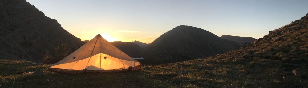
The last 15 miles were on paved toad

No getting lost on these trails

The trail turned out to be easy to follow and fast, the mountains mostly rolling, and the last 15 miles were on paved roads so by just getting up early and walking until well after sunset, it was possible to put up big miles.

During the night walk,the forest service was experimenting with using dogs to protect the sheep in the adjacent fields so for miles, in the dark, I was followed at a distance by one barking howling dog after another. I was walking by starlight without a headlamp but the dogs always seemed to know where I was.

When I got to Anaconda, the first thing I did was to get a big 32oz sugary soda and an ice cream, find a place to stay, then sleep for a good chunk of the afternoon remaining to recover. If you include some of the detours I took and the wandering about town, it was over 80 miles in less than 48 hours. If you include the extra half day of sleeping to recover from this crazy effort, the average was not so impressive. Won’t be doing that again.

Giant slag pile near open pit mine in Anaconda MT. The area around the smelter is on the national Superfund priority list.

The new shoes on the left did the Kessel Run in less than 12 parsecs. The torn up shoes on the right made it through about 600 trail miles in about 3 1/2 weeks and into the trash bin. Bye old buddies!

Anaconda was beautiful, the folks friendly, and I was able to meet up with a pile of trail buddies (most of which hitched into town), but I was eager to get back into the mountains. The next section would not be so easy.

Posted in CDT

CDT: Spotted Bear, Bob Marshall, and Scapegoat Wilderness through Helena MT

The forests south of Glacier National Park represent some of the most pristine wilderness in the lower 48. These forests have also been subjected to extensive fires over recent years and that means lots of fallen trees across the trail (deadfall). Although sad and starkly beautiful, these burn areas are a pain in the biscuits, literally. The 8 mile stretch of the CDT south of Glacier consisted of relentless scrambling over down trees fallen across the trail which took much of the day to cross. Added to the numerous holes in my pants from crawling under barbed wire in New Mexico were now some huge tears from getting snagged on the deadfall. Part of what made this frustrating was a cleared road visible below that paralleled the trail but was nearly impossible to get to. Aaaaarrrrggg!!! Fortunately, the only thing getting snagged was my pants. Could be worse. Later that day, I met Cricket and her little dog Chip who had made the same mistake as I and had decided to camp just after the worst of the deadfall. We immediately hit it off and started to hike together.

Grizzly bear in the Spotted Bear Wilderness

Cricket carrying Chip as his tired chihuahua legs get a short break.

Chip tucked into his cozy papoose

We decided to take the beautiful Spotted Bear Alternate which took us close to the Pentagon and Trilobite mountains.

It’s pretty typical for thru hikers to get out of sight of one of another. Unbeknownst to me, Cricket, who has been ahead, had missed the turn at the Gooseberry Guard Station while I added a couple extra gears to “catch up” to her. The effect was that we got increasingly separated.

Camping in the Spotted Bear under Pentagon Mountain

Dean Lake in the Spotted Bear Wilderness

A snowy climb through Switchback Pass

Switchback Pass

Above the clouds in the Bob Marshall Wilderness

Guard station in the Bob Marshall Wilderness: Note the Bear claw and teeth marks

Small orchids in the Bob Marshall Wilderness

Spider in the Bob Marshall Wilderness

As the altitude increased, the snow patches started to join up until the snow was continuous but it was still easy to stomp and bare boot through and over Switchback Pass until the Chinese Wall appeared on the other side of the pass.

Chinese Wall

More Chinese Wall

Camp in the Bob Marshall.

Since it was only me now, I decided to make a 32 mile run for the trail head where I could hitch a ride to Augusta MT. Having reached the trailhead by 6p, I waited and waited for a ride then gave up and started walking down the road. There were zero outbound cars going more than a mile or two down the road during that time. Augusta was 30 miles away and I was just about out of food so what choice did I have? I spoke with a woman in one car (heading the other way) and she said that I might be able to get some phone reception about 10 miles down the dirt road and maybe I could make a call. The map indicated that there was an airport on the way too. Hey, there had to be traffic coming in and out of the airport. After a few miles, I reached the “airport” which turned out to be just a long dirt runway with a tractor and a little run down building the size of a privy but unfortunately not a privy. OK, more walking. After a couple of hours it was getting dark so I decided to camp and try again in the morning. The next day, after walking a few more miles, the first outbound car picked me up, yay!!!!

A super nice rancher picked me up. I even got to ride in the front instead of with the trash in the back of the truck.

Unloading trash at the town dump.

The rancher had lived here most of his life and was pretty proud of his town. He gave me a ride all the way to Augusta, gave me a tour, and dropped me right in front of the Bunkhouse Inn. Every Montanan I had met was incredibly nice and generous. No one was there at the Inn but I was able to call Terri Lee who ran the Bunkhouse. Since the rodeo was in town, I wasn’t expecting much but it turned out someone had just cancelled and she would hold the room for me, score!!! Pacer (who was camping in someone’s back yard) was already there and so was Mister Fish. It was nice to see some familiar faces.

Kids scrambling for candy tossed off the parade floats

Pants repair with dental floss.

Definitely not cowboy boots.

While eating a double breakfast (eggs, toast, kitchen potatoes, and a large stack of pancakes with OJ) at Mel’s Diner across the street, I met the nice couple who had canceled their room at the Bunkhouse. These coincidences happen in small towns. A parade followed with floats and music, and candy, frisbees, and beer cozies being tossed to the kids. It was great!!!!!

Cricket and Chip showed up after the parade, woohoo!! Terri was ok with us sharing a room for the next couple of nights and we fought over who would get the floor. The compromise was that Cricket would get the floor the first night and me the second. Chip was so excited he just rolled around his back on the bed for about 5 minutes!

It was pretty clear who was in town for the rodeo and who were hikers. The rodeo folks were wearing their blue jeans, cowboy boots, and cowboy hats. I, for example, was wearing my long underwear and rain skirt since I was doing laundry. Pacer was wearing his Grateful Dead t-shirt. Cricket had her leopard print top on and sandals with ace bandages on her feet. The next couple of days in town were just a big party because of the rodeo.

We were able to get a ride out of town and back to the Trailhead with Terri Lee.

Ride to the trailhead in Teri’s shagged out van.

The next few days, the trail followed the beautiful ridge line of the Continental Divide.

Cricket was able to connect with a couch surfer in Helena named Tyler for both a ride into town (otherwise a 20 mile hitch) and a free place to stay.

Pajama party in Tyler’s living room in Helena with Woodchuck, Tyler, Cricket, and Chip.

Tyler is awesome and fun and generous and cool. He showed us around town and brought us to the best breweries, ice cream shops, let us crash on his floor, and was generally just a genuinely kind super generous and caring guy. Helena has been an awesome town but I am eager to get back on trail again. Next stop, Anaconda MT. It will be nice to be back on trail.

Posted in CDT

CDT: Glacier National Park, MT

I LOVE THIS WORLD!!!

I love the rain. I love the cold. I love the wind. I love this life. It’s hard to explain the joy of being blasted by cold knockdown winds going up a mountain pass and then having the vista open up into a whole new world as you peek over the top. It’s got to the point where I have a hard time sleeping indoors. The woods are my home now. Every day the trail brings more magic, more surprises, and more joy.

As you might remember, I decided to bounce up north and go SoBo (south bound) after getting my biscuits burned by the snows in The Wind River Range in Wyoming. Going SoBo gave time for the snows to melt while still getting the miles in. Getting to Glacier National Park was a combination of yogi’ing (basically chatting w folks and asking for a ride after you’ve convince them you’re not an ax murderer), a car rental, an Uber, and a lot of hitchhiking. You meet the best folks hitchhiking. You rarely get picked up by anyone driving a nice fancy car. Most of your hitches will be in old beat up pick up trucks or beater vans or cars with broken windshields. It seems that folks without very much are the most generous to share what they do have. I was picked up by a family from the Blackfeet Tribal Nation and it was so great chatting about their life, bumping fists, and having the dad ask me to call him Paint and me asking him to call me Two Forks. I was picked up and driven all the way to the Canadien border, 40 miles out of his way, by a Blackfeet spiritual singer songwriter talking about the universe and having him call me his brother and give me his phone number.

No I’m not done. ~1000 miles down with ~2000 miles to go.

At the Canadian border, the customs agent was nice enough to come out and snap a picture of me. My permits for Glacier were to start at the Chief Mountain Trailhead. Apparently there was a deer carcass on the trail on the Waterton route which was likely to attract a lot of bears so there were some trail closures and we were directed to the alternate starting point.

Within the first couple hours of walking, the Belly Trail, I met a group of high school girls and their guide who had been put out for four days in Glacier. The only wildlife they had seen were a few ground squirrels and a deer. That wasn’t so encouraging. I was hoping to see at least a goat or a sheep or even a marmot. Within 10 minutes, I saw my first grizzly bear about 200-300 yards away across a sunny meadow. That was great until it was clear that the grizzly bear saw me too and galloped full speed right at me. Holy crap!!!! In slow motion I was reviewing in my head the video that the back country rangers made us watch of what to do to keep the grizzly from clawing your intestines out once it knocked you down. As it bounded closer and closer, I pulled out my bear spray. As it got even closer, off came the safety and I aimed it at his head with my finger on the trigger. And then, suddenly, as he got close, he just rounded up, spun around, and bounced away just as fast as he had come. Wow, I was just bluff charged by a grizzly bear!!! By the time I came to my senses, dug my phone out, took off the wide angle lens, turned the phone on, found the camera app, and took a picture, the bear was a dot in the distance.

A grizzly bear or is that Bigfoot?

At that point I realized, that this trip through Glacier was going to be really great.

Glacier was beautiful. 6 easy days of bears, elk, deer, moose, mountain goats, big horn sheep, waterfalls, snowy passes, glacial lakes, and big sky vistas.

Grizzly front paw print.

Ground squirrel

Elizabeth Lake

Bull moose in Elizabeth Lake

Trails were easy to follow

Elk does

In some areas, the trail felt like a city park.

On hike to Atlantic Creek

Deer digging for dinner near Many Glacier. I saw one tourist almost mace a deer that was in the trail peacefully feeding on grass.

So many waterfalls in Glacier

Red Gap Pass

Red Gap Pass

Yes, it’s snowing.

Marshall at Piegan Pass

Blake and Marshall on Piegan Pass

https://mountain-boy.com/wp-content/uploads/2019/06/img_9278-1.mov

Victoria Falls

Filtering water on Red Eagle Lake

Red Eagle Lake

Triple Divide Pass

Walk to Triple Divide Pass

View out of privy at the Morningstar Campsite.

Seven Winds of the Lake

Pitamakan Pass from Dawson Pass Trail

Walk from Two Medicine to East Glacier

Big Horn Sheep Mama

….and her baby

Walk to East Glacier

Posted in CDT