CDT: Rawlins WY to Steamboat Springs CO – Crossing into Colorado and the Mt Zirkel Wilderness

Making it to Pinedale filled in the northern hole in my completion of the CDT. Now I still had to fill in the southern hole that extended from Rawlings WY south to nearly the southern border of Colorado. After a very welcome visit with Vanessa , friends, and my brother Lou and his family in Boulder I found myself back in Rawlins WY.

Deer in front of Library in Rawlins, WY

Apparently Darn Tough socks are only good for about 1000 trail miles.

Time for new shoes while in town. Pair number 4 and pair number 5.

40 miles of paved road walking next. Sigh…. That’s. what I had to look forward to. The official CDT trail south was purported to be poorly marked and hard to follow, was 20 miles longer, with views that weren’t any better than the road walk, and without even an antelope to keep you company. So the road walk it was and whinging about it didn’t bring Colorado any closer.

Fortunately road walks are fast and I was done with it in a day and a half. I’ve never listened to so many podcasts. Course it didn’t feel so fast at the time as I was running out water and had to rely on muddy streams and a silty reservoir for water.

I was too afraid to push this cloudy mess through my water filter so used bleach instead. Mmmm.. delicious pool water 🙁

After the road walk, I was so happy to see trees again and the last 25 miles on forest roads and trails went pretty uneventfully. The hitch into Encampment WY went quickly. I’ve been getting much better at looking more like a harmless hiker and less like a serial killer.

Resupply consisted of a walk to the neighboring town of Riverside and the resupply was from a gas station. Glad I’ve been packing extra vitamins. The next day, a very nice woman soon picked me up and went 24 miles out of her way to drive me to the trailhead. Once again, I was amazed at how generous folks have been to me on this trail.

I was happy to be back on trail again since my goal that day was to finally cross the Colorado border.

Finally at the Colorado border.

Left foot Wyoming, right foot Colorado.

Mud sometimes sucks your shoes right off.

So many wildflowers on trail.
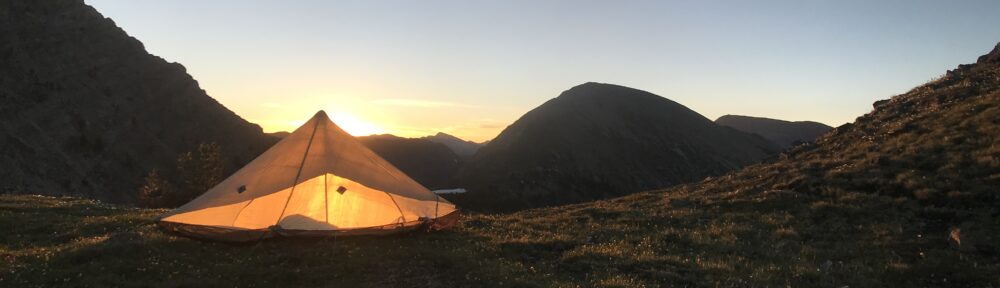
Sunset

The highlight over the next few days was the hike through the Mt Zirkel Wilderness. I have to admit that after 2100 miles on trail, I had stretches of wondering why the heck I was out here. Was I just working on checking a box off on my bucket list? Was this really worth it? These thoughts usually came during long road walks or days of hiking through swamps swarming with biting flies and mosquitoes. Climbing up Lost Ranger Mountain in the Mt Zirkel Wilderness reminded me of why I was here. Finally I was in the mountains again.

Mountain Goat near Lost Ranger Mountain

https://mountain-boy.com/wp-content/uploads/2019/08/img_1702.mov

The descent down to Steamboat Springs consisted of meadows full of wildflowers and lake after lake. Suddenly there were lots of people who were clean, happy, with new gear, and smelling like strawberry infused shampoo. Civilization. This was a huge contrast to the previous days where maybe I was seeing 2-3 folks a day and they generally smelled, let’s call it earthy.

On the hitch into town I was picked up by Karen and Johann who invited me to stay in their home in Steamboat Springs. Wow!!!! What an incredible act of generosity inviting a complete stranger into their home. They lent me a bicycle to do chores around town, fed me a delicious dinner, and sent me on my way back on the trail bright and early. What incredible folks.

Johann and Karen

Directory in local Safeway showing where to find different food items. Why don’t we have this back home?

Description of what free range, cage free, and conventional eggs means in local Safeway.

Wildflowers everywhere.

Wildflower meadow outside Steamboat Sprints.

There is a saying that “The trail provides”. No, it’s actually kind and generous people that provide.

Posted in CDT

CDT: Green River Campground to Pinedale WY – The Northern Wind River Range

If all went well, in two days I would be in Pinedale and on the next day headed down to Denver to see Vanessa before she flew back home to Massachusetts. I had been really really missing her and it was driving me to go for big miles over the last few weeks just to have a day with her. First though, I had to get over Knapsack Col. This day would be nearly 30 miles with more than 6000′ of total climbing to over 12,000′ with the higher altitudes characterized by snow fields and rock scrambling. About half of the write-ups I could find said that it was way too sketchy and that they would never do this hike again. The other half said that it was stunning and beautiful and should not be missed….. so I listened to the later folks and off I went. It turned out Cube Rock Pass and Knapsack Col were exactly as they were described. You had to earn the right to immerse yourself in them but they both turned out to be some of the most beautiful places I’ve ever been.

Bull moose at sunrise along the Green River

Flat Top Mountain

Green River

Cube Rock Pass was filled with refridgerator and house size boulders that you had to scramble over and under with no descernable path through much of them.

Cube Rock Pass

https://mountain-boy.com/wp-content/uploads/2019/08/img_1346.mov

Between Cube Rock Pass and Knapsack Col

Knapsack Col had a similar rock scramble next to the glacier that extends underneath the couloir at the pass to a thousand feet below. Many of even the larger rocks had not settled and more than once I had large door size boulders start sliding underneath my feet which had me leaping sideways to keep from tumbling down after them. It was a harsh and stunning landscape. One person I met described it as a power place and it was all of that. On descending down to Titcomb Lakes 2000′ below the pass, there were a lot of folks camping. In fact the whole valley was filled with tents especially since much of it was accessible through either an easy mostly flat backpack from Elkhart Park. A lot of folks also simply rode horses with outfitters carrying their gear in. I camped above beautiful Island Lake surrounded by innumerable tents and packed out at first light.

Sandbag NoBo In descent of Knapsack Col

Snowfield on climb up Knapsack Col

Couloir at Knapsack Col

View of Twin Glacier on Knapsack Col

Snow field on Knapsack Col

A lot of tents around Titcomb Lakes

Dinner spot along Titcomb Lakes

The 13 mile hike to Elkhart Park (which included some delicious peanut butter cookie trail magic at the trailhead) was followed by a 15 mile roadwalk into Pinedale where I had originally flipped up from to go to Glacier. It felt a bit surreal walking back into Pinedale. This marked over 2000 miles on trail and closed out all of the CDT for me north of Rawlins WY. I would first be going back to Denver to see Vanessa and now it seems my brother Lou and his family, and then off to finish Colorado.

Sunset

View from campsite over Island Lake

Island Lake

Hike out on Seneca Lake Trail

Greeting party on hike to Pinedale

Yay!!!! Back in Pinedale.

T shirt in store window in Jackson for flight to Denver.

Elk horns in Jackson, WY

No dehydrated food for the next few days.

Posted in CDT

CDT: Yellowstone WY to Green River Campground

Upper Geyser Basin

I have to admit that I was a little intimidated by the huge crowds of tourists in Yellowstone. Once you learned the rhythm of the place it wasn’t so bad though. Beyond the heart of the Geyser Basins and outside a couple miles of any trailhead, you really didn’t see hardly anyone. Even around the Old Faithful Village, if you wanted to go into the shops or get something to eat, you just timed going with the projected eruptions of Old Faithful and the shops and restaurants would be close to empty. After getting my permits though, retrieving my package from the Post Office, doing quick resupply, and visiting my neighbors Jonathan, Amy, and Julian for a couple hours, I made a beeline back into the backcountry. Seven miles later, I had a nice quiet campsite all to myself with no one else in sight.

It was a treat seeing my neighbors Jonathan, Julian, and Amy

Easy hiking through Yellowstone.

The Yellowstone that the CDT runs through is surprisingly free of any animals. Besides a few squirrels, chipmunks, and a few birds, I didn’t really see anything. There were, however, clouds of mosquitoes. The Geyser Basin is basically a big swamp filled with geothermally warmed soupy water. Perfect mosquito habitat. Where there weren’t mosquitoes, the gap was filled by biting flies which were worse. Mosquitoes would at least respond to a healthy coating of DEET. The flies only responded to a quick swat. The problem was that there seemed to be a bottomless supply of biting flies. The only defence seemed to be to keep moving.  Often this was tricky as large stretches of the trail passed through mucky bogs that seemed to want to suck the shoes off your feet. On the  positive side, I was starting to meet up with some trail family that I had last seen in New Mexico. I met up with Armstrong, Bobber, Mighty Mouse, and Montana. It was really great catching up and they gave me some great beta on a thermal stream before my next camp at Beaver Creek above Heart Lake. The thermal stream was a stream with water that was running at about 102F and right next to the trail. I probably spend an hour in there floating as the rapids worked over my shoulders and washed all my clothes (didn’t bother stripping).

Soaking in a thermal stream

Doing laundry on hot cycle.

At Beaver Creek Campsite, I met back up with the posse and in the morning said my final goodbyes. Meredith, Southie, and Chip’n were headed to the Teton Crest Trail and Wilder was bolting south to Lander and then back home to be with his girlfriend. We didn’t expect to see each other again.

More easy walking south of Yellowstone

The next few days were quiet and I spent most of the time by myself hardly seeing anyone except Toy Story on a few occasions. The most interesting place I visited was Two Ocean where a stream split in two with the left fork going to the Atlantic Ocean and the right fork winding its way to the Pacific.

Two Oceans campsite

Water to the left fork goes to the Atlantic Ocean and water to the right fork winds it’s way to the Pacific

One of these mornings, I had to do my daily constitutional. Now my typical pattern is that I find a section of non switchback trail that is easy to find again (in this case a forest service road) then go a couple hundred feet off trail behind some cover. In this case, I had to climb down and over two gullies and over a bunch of deadfall to find my private spot behind a pine tree. There I was, pants around my ankles, in the process of filling my little cat hole when I hear voices in the distance getting steadily louder. These are the first human voices that I’ve heard in almost a day. They voices just got louder and louder and they were whinging about how hard the trail was to follow. Somehow, in the middle of all that wilderness, this middle aged section hiker couple had gotten lost off the forest service road and found my poop spot in the middle of bloody nowhere. Seriously, what is the probability of this happening. They literally passed withing 5 feet on the other side of the tree I was squatting behind then turned around and looked right at me. I pointed to the forest service road that was clearly visible from that spot and told them that was the trail they were looking for. The dude seemed to want to have a conversation and kept turning around and opening and closing his mouth. I mean, Cheezits Lites man, can I have some privacy? They finally wandered off in the direction of the trail and I could finish my business. On the plus side, I was down to using only 4 squares of TP a day. Afterwards, I felt a little sorry for them. If they could get lost on a forest service road, their CDT was going to be long and frustrating.

How do you get lost off of this trail?

Now that’s a fancy pit toilet (Brook’s Lake)

My main objective during this time was to make it to Brooks Lake Lodge which is where I sent my next resupply box. The problem was, when I got there, my box was missing. My UPS tracking number said that it had been delivered but it was not there. Now, it turns out that there was a fire in the building housing the packages and that some of the packages were water damaged but the manager in charge was convinced that no packages were actually destroyed. In any event, whether destroyed or taken, the 4 days of food that I needed to get to Pinedale was not there and my schedule did not allow me to burn a day hitching into town to resupply. My only choice was to raid the hiker box. To augment what little food I had in my bag (there was a day and a half food left over as I was moving faster than planned) the hiker box had a pile of PowerBar Protein Bars, a partial box of very stale Cheezits, a bag of Goldfish of unknown age, and some ramen packets. Smooth just happened to come in while I was sorting through the food and I was able to barter fixing his leaky water filter for a Clif Bar and a Granola Bar, score!!!!!

Four days of snacks abandoned in hiker box

Over the next few days I discovered why someone had abandoned that big pile of PowerBar Protein Bars. Between overdosing on stale cheesy salty junk food and eating several of these abandoned protein bars each day, it was a bit of a digestive disaster. Lets just say that I was going through more than 4 sheets of TP a day and felt like my insides were about to explode at any second.

A lot of butterflies like poop

Weather moving in followed by hail

Boomers coming this way

Lazy sunrise in camp after lightning storm

While hiking over Gunsight Pass, I met Bartender and a couple of other hikers who told me about a hiker wedding that was going to happen later that day in the Green River Campground and that if you were Hiker Trash, you were invited. Woohooo! That was just where I was headed then. Not long before the turnoff, Chip’n had showed up. It turned out that they had blitzed the Teton Crest Trail and had gotten a ride back to the CDT from a Trail Angel. Meredith, and Southie were not too far behind him. A lot of other folks had also heard about this wedding and were coming in from all over. Pinestake, Blackfoot, and Cow Bell showed up who I had last seen in New Mexico as was Twig and Relentless. Wilder also somehow showed up so the posse was back together again. It was a crazy, joyous reunion without a protein bar in sight. The couple, Trail Wife and Copenhagen, were awesome and the ceremony touching. It was another bit of trail magic outside of the realm of normal life. At sunset I packed up and hiked into the night and into the Northern Wind River Range to make up time.


“Hiker Trash” wedding reception

Thru Hiker wedding at Green River Campground

Posted in CDT

CDT: Darby MT to Yellowstone WY – The Idaho/Montana Border

We were surprised to see so many of the posse already in Darby by the time we arrived. I had done a 35 miler the day before and was several miles past where the posse had camped. Chip’n had got up in the dark at 4:30A and started hiking well before anyone else was even stirring. Meredith was also up and out not long after Chip’n and had reached me at sunrise just as I was stepping out onto the trail. We reached Chief Joseph Pass by 11A with me having done nearly 15 miles and them nearly 20 miles and then got a hitch with nearly the first car that went by. It turns out that a few of them took a bushwhack shortcut through the woods to one of the roads and hitched from there skipping a nice long section of trail. Bloody Hell! I have to keep reminding myself that everyone has their own idea of what a thru hike is and that it’s not a race. In any event, it was nice seeing everyone in town. Besides, it was Meredith’s birthday and a time to celebrate.

With Meredith and Chip’n at the Idaho border

The next morning, I was feeling pretty shaggy so I got a quick haircut and then headed out of Darby solo. Once again, only a couple of cars went by before I was picked up. Although the first ride was only a few miles, the driver was fun to talk to and I got a second ride right away that took me right back to the trail head. Montana is the best place anywhere for hitchhiking.

Southie enjoying first and second breakfasts

On the second day out, I was privileged to see, from a distance, two bull elk fighting horn to horn while a herd of doe elk looked on. The rut was just starting. Normally they would have noticed me well before I noticed them.

Trail following the Continental Divide

The spring in Sacajawea Park believed to be the headwaters of the Missouri River

Herd of elk

It was during this time that I was able to contact my trail buddy Radioman from the Appalachian Trail and he said that he would like to get me some trail trail magic in 2 1/2 days when I got to Bannock Pass. Yikes, that was 80 miles away through the mountains! I’d have to get my hustle on again. Fortunately the last day was an easy descent and I was able to squeeze out 20 miles by 1P to be on time where Radioman had fresh fruit and beer waiting for me. It really was great seeing Radioman. It turns out he drove 5 hours one way across Idaho to meet me. Unbelievably generous of him. We stayed at a friend of Radioman’s in Salmon ID, and after a quick resupply, dinner, clean up, good night’s sleep, and a delicious breakfast, he dropped me off where he had picked me up only to be greeted by about half of the posse who were a day behind me and looking for a ride to Leadore, ID.

Radioman dropping me off and picking up the posse to go to Leadore, ID

The next section of the CDT to Lima MT saw the trees thin to grassland and sagebrush. The wary pronghorn antelope were starting to show up again. You would often hear the antelope barking at you before you saw them but sometimes you could sneak to within 50-100 yards of them before they noticed you. It was through this section that the CDT would often just disappear and you would just follow a valley or bowl or meadow or compass heading indicated on your topo map.

Trail out of Bannock Pass

Wildflowers on Elk Mountain

Lunch stop on the Continental Divide

Water was scarce and welcome along the ridge line

Doe Elk are usually pretty wary

On the last section before Lima MT, the CDT follows the treeless ridge line of the actual Continental Divide. It’s a strange feeling when you think that your left foot is in Montana and your right is in Idaho. Raindrops falling to your left will eventually find their way to the Atlantic while raindrops falling to your right will eventually make their way the Pacific. For some of this ridge-line I walked with Wilder until he bonked and dropped off to take the easy valley floor (he had been doing big miles to catch up to me), but much of it I walked alone. Like much of the CDT, it was difficult, and brutal, and beautiful. After a glowing sunset, I rolled into camp and pitched my tent not too far from Wilder so we could catch a ride into Lima Mt first thing in the morning.

Blue columbine

Blue columbine

Found…….. Ate.

Wilder on the Continental Divide

Following the Continental Divide

Wilder in tunnel going under the interstate highway

The next morning, after a 7 mile hike out, we were picked up on the side of the highway by Mike and his dog from the Mountain View Motel in Lima. During the day, other folks from the posse slowly trickled in until we had quite a group assembled. Toward the end of the day, Ninja (whom I had last seen at Chief Mountain in Glacier) and Snapper also showed up. Over the next few days we would take the Mack’s Inn Alternate which was the straightest path to Yellowstone and also would take us through Island Park ID for an easy resupply. The trail was fairly uneventful except for the clouds of biting flies and mosquitoes and occasionally getting lost. It was a nice change though to camp with the posse through much of this section.

You can rent these if you’d like a place to stay in Lima

Yes, he is doing what you think.

The posse back on trail

Trail gourmet involving cheese and some kind of crunched up chips.

A lot of little ponds and thus swarms of mosquitoes

On the day before going into Yellowstone, we had assembled a big group of hikers right before the park boundary so we could all make the 19 mile dash to the Backcountry Office in Yellowstone to get our campsite permits for the next couple of days as we traversed through the park. I left camp early as I also wanted to catch the Post Office before noon as I had a resupply package waiting for me there and also, my neighbors just happened to be in Yellowstone at the same time and the early start would allow a nice visit.

Posse hitching a ride through the road walk

https://mountain-boy.com/wp-content/uploads/2019/08/img_0980.mov

If you look carefully, the kitty seems to be eating pizza then a taco.

Lunch break next to a spring with Ninja, Snapper, S&M, and Wind NaN

Camp on Yellowstone Border

Wyoming / Idaho border

Yellowstone at sunrise

New Mexico -done

Montana -done

Idaho -done

Posted in CDT

CDT: Anaconda MT to Darby MT– Pintler Range

Sunrise at Storm Lake Pass

It’s hard to get excited about road walks. To get out of Anaconda and back on trail required another 20 to 25 miles of paved and forest road walking in hot weather so I have to admit to not being particularly excited about getting out of town. On the plus side, I did run across Woodchuck, Wow!, and Eagle Cow while walking through town. About 10 miles into the road walk, Brock and Morning Glory caught up to me while I was scrambling down an embankment for some water and their company made the time pass much more quickly. It tuns out that most of the rest of their posse had hitched past this 20-25 miles of road and were already up ahead. Storm Lake marked the end of the road section and the welcome resumption of trail. When we reached Storm Lake, the mosquitoes were hungry and swarming but it was still worth a quick swim in the icy cold lake (fed by snow melt). There are few things more welcome than a swim at the end of a long hot sweaty day.

Brock in Storm Lake

After dinner and getting tired of swatting mosquitoes, I decided to chase the sunset and make the 1000′ foot climb over Storm Lake Pass alone. As beautiful as lakes are, they are almost always accompanied by clouds of biting insects. The climb was an uneventful easy series of switchbacks with just the occasional patch of snow to cross.

View over Storm Lake

View up climb to Pass

Storm Lake Pass

Storm Lake Pass was a breathtaking entry into the Pintler Range. One moment you are looking over a snow fed lake and then you pop over the pass which opens up into a huge bowl dropping into a valley a thousand feet below you. Although I had missed the sunset, I was not going to miss the sunrise so I set up my tent right on the edge west side of the bowl facing the east.

The next few days in the Pintler Range were beautiful and stark and difficult with long stretches above treeline and huge elevation changes. The physical stress of the constant ups and downs, however, was mitigated by the beauty of each new landscape as you made up through another pass. One day, I went through five passes. It was glorious as each new world opened up before me.

Bowl near Storm Lake Pass

Goat Flats

Pintler Range, Montana

Pintler Range, Montana

Morning Glory in Pintler Range, Montana

While sitting in a small field of wildflowers near one pass and eating lunch, a hummingbird flew to within a couple inches of my right knee, looked right up at me, then quietly dipped her beak into a flower and flew off. These are things that almost seem like dreams and that you never forget and never experience in the “real” world. I’m more and more questioning these days which to call the “real” world. There is the way you wish the world was and then there is the way the world is. The more time you spend in the wilderness, the easier it is to get lost in the former.

Fred and Pauline

Rainbow over Rainbow Lake

Pintler Range, Montana

It was during this time, I was really happy to meet up with Fred and Pauline (sadly only briefly though) who were traveling northbound and soon after caught up with the posse and made it to the Idaho/Montana border where I caught a hitch into Darby Montana with Chip’n and Meredith. Yay!!! Town day 🙂

Caught up with the posse. There were a series of incredible lightning storms through the night.

Morning Glory catching a sunset.

Pintler Range, Montana

With Meredith and Chip’n at the Idaho/ Montana border

We actually got to sit inside the truck on this hitch!

Posted in CDT

CDT: Helena MT to Anaconda MT – Doing the Kessel Run in Less than 12 Parsecs

Couch surfing at Tyler’s in Helena with Woodchuck, Cricket, and Chip

I had been feeling a bit homesick lately and really missing my wife Vanessa, my friends, family, the ocean, and my other life. I wasn’t on trail to run away from this life but rather to experience some of the wildest parts left of this country, go on a grand adventure while my body was still up for it, and hopefully come back as a better person for it. For a while, I needed to strip down my life to the basics as my real life had become too cluttered. As Thoreau wrote:

I wanted to live deep and suck out all the marrow of life, to live so sturdily and Spartan-like as to put to rout all that was not life, to cut a broad swath and shave close, to drive life into a corner, and reduce it to its lowest terms.”

Lowest terms for me still includes a budget of about 8 sheets of toilet paper a day but I’m working on that. Lowest terms also includes Vanessa whom I miss terribly and it turns out will be Colorado with friends until about August 10. If I can average 25 miles a day (including nearoes and zeroes), I’ll be able to make Pinedale WY to finish up Montana, Idaho, and northern Wyoming just in time to flip down to Colorado to give Vanessa a kiss hello and goodbye in the Denver Airport when she flies back home. This was not going to happen unless I set out on my own and started making serious tracks southwards.

So….. Cricket and I said our teary goodbyes in Helena and the next day we split. Now I was coming off of a nearo and a zero, had a belly full of good town food, had 2 long nights rest, had been doing short (mostly 20 mile) days with Cricket, and had just got my new trail runners. I was flying down the trail which mainly consisted of forest roads and was passing everybody. At some point it occurred to me that I had a chance of doing the 79 miles from Helena MT to Anaconda MT in under 48 hours. This would have seemed like crazy talk a few weeks before (I had never done more than 32 miles in a day) but with all the road walking, easy trails, less than 4000′ of climbing a day, and feeling really good for this segment, it wasn’t seeming so crazy anymore.

View from Thunderbolt Mountain

The last 15 miles were on paved toad

No getting lost on these trails

The trail turned out to be easy to follow and fast, the mountains mostly rolling, and the last 15 miles were on paved roads so by just getting up early and walking until well after sunset, it was possible to put up big miles.

During the night walk,the forest service was experimenting with using dogs to protect the sheep in the adjacent fields so for miles, in the dark, I was followed at a distance by one barking howling dog after another. I was walking by starlight without a headlamp but the dogs always seemed to know where I was.

When I got to Anaconda, the first thing I did was to get a big 32oz sugary soda and an ice cream, find a place to stay, then sleep for a good chunk of the afternoon remaining to recover. If you include some of the detours I took and the wandering about town, it was over 80 miles in less than 48 hours. If you include the extra half day of sleeping to recover from this crazy effort, the average was not so impressive. Won’t be doing that again.

Giant slag pile near open pit mine in Anaconda MT. The area around the smelter is on the national Superfund priority list.

The new shoes on the left did the Kessel Run in less than 12 parsecs. The torn up shoes on the right made it through about 600 trail miles in about 3 1/2 weeks and into the trash bin. Bye old buddies!

Anaconda was beautiful, the folks friendly, and I was able to meet up with a pile of trail buddies (most of which hitched into town), but I was eager to get back into the mountains. The next section would not be so easy.

Posted in CDT

CDT: Spotted Bear, Bob Marshall, and Scapegoat Wilderness through Helena MT

The forests south of Glacier National Park represent some of the most pristine wilderness in the lower 48. These forests have also been subjected to extensive fires over recent years and that means lots of fallen trees across the trail (deadfall). Although sad and starkly beautiful, these burn areas are a pain in the biscuits, literally. The 8 mile stretch of the CDT south of Glacier consisted of relentless scrambling over down trees fallen across the trail which took much of the day to cross. Added to the numerous holes in my pants from crawling under barbed wire in New Mexico were now some huge tears from getting snagged on the deadfall. Part of what made this frustrating was a cleared road visible below that paralleled the trail but was nearly impossible to get to. Aaaaarrrrggg!!! Fortunately, the only thing getting snagged was my pants. Could be worse. Later that day, I met Cricket and her little dog Chip who had made the same mistake as I and had decided to camp just after the worst of the deadfall. We immediately hit it off and started to hike together.

Grizzly bear in the Spotted Bear Wilderness

Cricket carrying Chip as his tired chihuahua legs get a short break.

Chip tucked into his cozy papoose

We decided to take the beautiful Spotted Bear Alternate which took us close to the Pentagon and Trilobite mountains.

It’s pretty typical for thru hikers to get out of sight of one of another. Unbeknownst to me, Cricket, who has been ahead, had missed the turn at the Gooseberry Guard Station while I added a couple extra gears to “catch up” to her. The effect was that we got increasingly separated.

Camping in the Spotted Bear under Pentagon Mountain

Dean Lake in the Spotted Bear Wilderness

A snowy climb through Switchback Pass

Switchback Pass

Above the clouds in the Bob Marshall Wilderness

Guard station in the Bob Marshall Wilderness: Note the Bear claw and teeth marks

Small orchids in the Bob Marshall Wilderness

Spider in the Bob Marshall Wilderness

As the altitude increased, the snow patches started to join up until the snow was continuous but it was still easy to stomp and bare boot through and over Switchback Pass until the Chinese Wall appeared on the other side of the pass.

Chinese Wall

More Chinese Wall

Camp in the Bob Marshall.

Since it was only me now, I decided to make a 32 mile run for the trail head where I could hitch a ride to Augusta MT. Having reached the trailhead by 6p, I waited and waited for a ride then gave up and started walking down the road. There were zero outbound cars going more than a mile or two down the road during that time. Augusta was 30 miles away and I was just about out of food so what choice did I have? I spoke with a woman in one car (heading the other way) and she said that I might be able to get some phone reception about 10 miles down the dirt road and maybe I could make a call. The map indicated that there was an airport on the way too. Hey, there had to be traffic coming in and out of the airport. After a few miles, I reached the “airport” which turned out to be just a long dirt runway with a tractor and a little run down building the size of a privy but unfortunately not a privy. OK, more walking. After a couple of hours it was getting dark so I decided to camp and try again in the morning. The next day, after walking a few more miles, the first outbound car picked me up, yay!!!!

A super nice rancher picked me up. I even got to ride in the front instead of with the trash in the back of the truck.

Unloading trash at the town dump.

The rancher had lived here most of his life and was pretty proud of his town. He gave me a ride all the way to Augusta, gave me a tour, and dropped me right in front of the Bunkhouse Inn. Every Montanan I had met was incredibly nice and generous. No one was there at the Inn but I was able to call Terri Lee who ran the Bunkhouse. Since the rodeo was in town, I wasn’t expecting much but it turned out someone had just cancelled and she would hold the room for me, score!!! Pacer (who was camping in someone’s back yard) was already there and so was Mister Fish. It was nice to see some familiar faces.

Kids scrambling for candy tossed off the parade floats

Pants repair with dental floss.

Definitely not cowboy boots.

While eating a double breakfast (eggs, toast, kitchen potatoes, and a large stack of pancakes with OJ) at Mel’s Diner across the street, I met the nice couple who had canceled their room at the Bunkhouse. These coincidences happen in small towns. A parade followed with floats and music, and candy, frisbees, and beer cozies being tossed to the kids. It was great!!!!!

Cricket and Chip showed up after the parade, woohoo!! Terri was ok with us sharing a room for the next couple of nights and we fought over who would get the floor. The compromise was that Cricket would get the floor the first night and me the second. Chip was so excited he just rolled around his back on the bed for about 5 minutes!

It was pretty clear who was in town for the rodeo and who were hikers. The rodeo folks were wearing their blue jeans, cowboy boots, and cowboy hats. I, for example, was wearing my long underwear and rain skirt since I was doing laundry. Pacer was wearing his Grateful Dead t-shirt. Cricket had her leopard print top on and sandals with ace bandages on her feet. The next couple of days in town were just a big party because of the rodeo.

We were able to get a ride out of town and back to the Trailhead with Terri Lee.

Ride to the trailhead in Teri’s shagged out van.

The next few days, the trail followed the beautiful ridge line of the Continental Divide.

Cricket was able to connect with a couch surfer in Helena named Tyler for both a ride into town (otherwise a 20 mile hitch) and a free place to stay.

Pajama party in Tyler’s living room in Helena with Woodchuck, Tyler, Cricket, and Chip.

Tyler is awesome and fun and generous and cool. He showed us around town and brought us to the best breweries, ice cream shops, let us crash on his floor, and was generally just a genuinely kind super generous and caring guy. Helena has been an awesome town but I am eager to get back on trail again. Next stop, Anaconda MT. It will be nice to be back on trail.

Posted in CDT

CDT: Glacier National Park, MT

I LOVE THIS WORLD!!!

I love the rain. I love the cold. I love the wind. I love this life. It’s hard to explain the joy of being blasted by cold knockdown winds going up a mountain pass and then having the vista open up into a whole new world as you peek over the top. It’s got to the point where I have a hard time sleeping indoors. The woods are my home now. Every day the trail brings more magic, more surprises, and more joy.

As you might remember, I decided to bounce up north and go SoBo (south bound) after getting my biscuits burned by the snows in The Wind River Range in Wyoming. Going SoBo gave time for the snows to melt while still getting the miles in. Getting to Glacier National Park was a combination of yogi’ing (basically chatting w folks and asking for a ride after you’ve convince them you’re not an ax murderer), a car rental, an Uber, and a lot of hitchhiking. You meet the best folks hitchhiking. You rarely get picked up by anyone driving a nice fancy car. Most of your hitches will be in old beat up pick up trucks or beater vans or cars with broken windshields. It seems that folks without very much are the most generous to share what they do have. I was picked up by a family from the Blackfeet Tribal Nation and it was so great chatting about their life, bumping fists, and having the dad ask me to call him Paint and me asking him to call me Two Forks. I was picked up and driven all the way to the Canadien border, 40 miles out of his way, by a Blackfeet spiritual singer songwriter talking about the universe and having him call me his brother and give me his phone number.

No I’m not done. ~1000 miles down with ~2000 miles to go.

At the Canadian border, the customs agent was nice enough to come out and snap a picture of me. My permits for Glacier were to start at the Chief Mountain Trailhead. Apparently there was a deer carcass on the trail on the Waterton route which was likely to attract a lot of bears so there were some trail closures and we were directed to the alternate starting point.

Within the first couple hours of walking, the Belly Trail, I met a group of high school girls and their guide who had been put out for four days in Glacier. The only wildlife they had seen were a few ground squirrels and a deer. That wasn’t so encouraging. I was hoping to see at least a goat or a sheep or even a marmot. Within 10 minutes, I saw my first grizzly bear about 200-300 yards away across a sunny meadow. That was great until it was clear that the grizzly bear saw me too and galloped full speed right at me. Holy crap!!!! In slow motion I was reviewing in my head the video that the back country rangers made us watch of what to do to keep the grizzly from clawing your intestines out once it knocked you down. As it bounded closer and closer, I pulled out my bear spray. As it got even closer, off came the safety and I aimed it at his head with my finger on the trigger. And then, suddenly, as he got close, he just rounded up, spun around, and bounced away just as fast as he had come. Wow, I was just bluff charged by a grizzly bear!!! By the time I came to my senses, dug my phone out, took off the wide angle lens, turned the phone on, found the camera app, and took a picture, the bear was a dot in the distance.

A grizzly bear or is that Bigfoot?

At that point I realized, that this trip through Glacier was going to be really great.

Glacier was beautiful. 6 easy days of bears, elk, deer, moose, mountain goats, big horn sheep, waterfalls, snowy passes, glacial lakes, and big sky vistas.

Grizzly front paw print.

Ground squirrel

Elizabeth Lake

Bull moose in Elizabeth Lake

Trails were easy to follow

Elk does

In some areas, the trail felt like a city park.

On hike to Atlantic Creek

Deer digging for dinner near Many Glacier. I saw one tourist almost mace a deer that was in the trail peacefully feeding on grass.

So many waterfalls in Glacier

Red Gap Pass

Red Gap Pass

Yes, it’s snowing.

Marshall at Piegan Pass

Blake and Marshall on Piegan Pass

https://mountain-boy.com/wp-content/uploads/2019/06/img_9278-1.mov

Victoria Falls

Filtering water on Red Eagle Lake

Red Eagle Lake

Triple Divide Pass

Walk to Triple Divide Pass

View out of privy at the Morningstar Campsite.

Seven Winds of the Lake

Pitamakan Pass from Dawson Pass Trail

Walk from Two Medicine to East Glacier

Big Horn Sheep Mama

….and her baby

Walk to East Glacier

Posted in CDT

CDT: Atlantic City WY (Mile 1743) to Pinedale WY (Mile 1828) The Southern Wind River Range

Having camped just a mile outside of Atlantic City WY the night before, I reached town first thing in the morning. Wild Bill met me outside of his B&B and immediately set me up with a little cabin. He and his wife Carmella are two of the nicest folks I’ve ever met. The temp had gone down to 24F the night before so the pipes were frozen to both the washer and the bathroom. This was crazy since it was mid June but it’s been a crazy year. After a hour though, everything was sorted out and Carmella had set me up with some herbal tea in fine china and fresh baked cookies and warm delicious brownies. This was a huge step up from my usual cow pond water and granola bar for second breakfast.

Tea time with Carmella’s fresh baked brownies and cookies at Wild Bill’s

Double Lunch at the Grub Stake in Atlantic City

Marco “Polo” and me enjoying dessert time with Carmella’s fresh baked apple ala mode at Wild Bill’s

Wild Bill was just in the process of putting in a hot tub for the hikers. Darn it! Missed the hot tub by 3 days.

I wasn’t quite sure what my next steps on the trail should be. Basically, I could either keep going north into the Wind River Range and try to push through the snow or bounce north all the way to the CDT northern terminus in Glacier National Park and start heading south. Montana had a nearly normal snow year and most of the snow had cleared out so bouncing up to Glacier and heading south was the sensible way to go. Of course I decided to continue going north through the Winds. This decision actually seemed crazy even to me. No one had made it through yet. Roadrunner had tried just a few days before but 25 miles in he made it to a river that he thought was too dangerous to cross then turned around and came just about all the way back. A horn hunter had also just gone missing in this same area. They later found his drowned body in a log jam. While looking for him using airborne FLIR, all they saw were elk and hungry grizzlies just coming out of hibernation. But some one had to be the first through and I had my bear spray, fancy new snow shoes, and Vanessa had just send me my spikes and ax.

So the plan was to keep going north through the Winds until it got too sketchy or the snow kicked my biscuits. Well, that didn’t take very long.

The next food carry was going to be the longest on the entire CDT at just a bit under 200 miles so I was carrying an enormous load of 10 days of food. That along with all my snow gear was well over the “oh my god, this is really heavy” backpack limit.

The first day was all under the snow line and much of it through beautiful pine forests. There was only patchy snow and it kind of felt like our late spring walks in New Hampshire. Because of the snow melt, water was everywhere and generally didn’t take like cow poop.

The start of the hike went through South Pass City: Population 4

Into the Bridger Wilderness. Do not expect a Wi-Fi signal.

It was the second day when the fun began. As the trail climbed closer to 10,000′, the patches of snow got more and more dense then continuous and then deep. The trail, which is normally hard to follow on the best of days with its lack of markers became nearly impossible to follow covered by deep snow and going through dense woods. The snow itself was a knee to hip deep slushy mess. Although my new snow shoes had plenty of float to stay on top of the snow, the spalling (snow build-up) on the snowshoe’s crampons destroyed any traction they might have had in the steep terrain. It was like having a little red saucer attached to each foot.

Spalling on my snow shoes

One of the few flatish spots above the snow line

I can’t remember slipping, sliding, falling and making so many snow angels in my life so off came the snow shoes and on went the MICROspikes. The postholing was not much better. Knee to waist high post holing through wet slush down into icy water underneath. It was no longer cold enough at night to freeze more than a thin top crust so I couldn’t play the trick of getting up at 2A and hiking while everything was frozen at night. At some point I realized that there was no way I was going to make it through 60 miles of this (which would start in earnest in a couple days) and that I would need to abandon the Winds for now and do the 60 mile road walk to Pinedale.

Little Sandy Lake in the Cirque of the Towers

Later that day, the trail descended below the snow line and I saw my first Wyoming elk herd on the CDT.

Bull elk in The Winds

Aspen grove

Aspen grove

The sound clip above is of coyotes howling near my camp.

I’d finally found the real wilderness that I had been looking for so long and now had to leave it. The Winds will still be there though after the snow melts and I’ll be back.

Trail magic beer on the road walk to Pinedale

Skeleton of pronghorn caught in barbed wire fence

Red Tailed Hawk with the clouds building into a storm

Royal was bicycling the pedal version of the CDT with his 80 pound rig

I want a mailbox like this!

Not a muppet

Pinedale, it really is all the civilization you will ever need.

Posted in CDT

CDT: Rawlins WY (Mile 1629) to Atlantic City WY (Mile 1743)

After making the decision to skip Colorado until the snow clears there, the next step consisted of working my way up to Rawlins WY from Chama NM. The only ways out of Chama were on foot (nope), hitch hiking (nope), or taking the free Blue Bus which only runs Monday to Friday. So first thing at 5:30 AM on Monday morning, we caught the blue bus which took us to Espanola after which we hopped onto another bus to Santa Fe. All of the other hikers that I was traveling with decided that they were going to head home for a while and wait for the snow to melt if they came back at all. They would all be heading to the airport in Albuquerque. Instead, I walked across Santa Fe to pick up my car rental and started my 8 hour drive to Laramie Wyoming where I would drop off my rental car. From there I would stay overnight and then take a Greyhound bus to Rawlins Wyoming the next day at 3P.

Another apocalyptic storm as viewed from the Greyhound “station” in Laramie

Lots of cool old cats out west

All went according to plan except the Greyhound bus. After waiting and waiting next to a big Greyhound placard stuck on the concrete wall of an old gas station that functioned as the “bus station”, it turns out that the bus was going to be 5 hours late, yikes!!!! Really? So… I figured, why don’t I try hitch hiking instead.

Hitch hiking to Rawlins from Laramie WY

Well that little experiment didn’t work. The only person who stopped tried to give me a dollar. He thought that I was homeless and felt bad for me. Unfortunately he was also going in the wrong direction.

So after the very late bus and the three mile walk across Rawlins to the Super 8 it was 11P. So much for All You Can Eat Thai food in Rawlins but, hey, I had made it.

The next morning, I started the hike north solo across the Great Divide Basin. This is a 115 mile patch of sagebrush in which none of the rain flows to any ocean (endorheic basin). Basically, it’s like a giant birdbath without a drain and actually without much water in it either. The trail started from Rawlins with a bit of a road walk which turned onto a nice dirt road that was easy to follow. Soon, however, the CDT started to become aspirational again. The markers started leading across untracked desert and with many of the already scarce markers knocked over by the wind or by animals until they just disappeared completely. Bloody hell, not again! Out came the GPS so I could roughly follow the trail and get to the next water source.

After about 15 miles, the CDT started to become a real trail again. In fact, it became very easy to follow as it was now an arrow straight road heading north and stretching to the horizon. I’d spend some amount of time hiking with my eyes closed and seeing how long I could Braille walk without going off trail or tripping over a sage brush. There wasn’t much out there besides me and the antelope.

Trail heading north in the Great Divide Basin

Pronghorn Antelope

Rainbow at sunset at the end of the first day in The Basin

After seeing only one other hiker the first day, I met maybe 20 thru hikers heading southbound the second. Their plan was to knock out the Great Divide Basin and keep heading south until the snow in Colorado stopped them again. The big wave of Northbound thru hikers had basically crashed upon the snows in Colorado and scattered up and down the CDT trying to work around this year’s record snow pack. They will probably be hitting snow again around Steamboat Springs in another week and then what?. Having lost so much time chatting that day with other hikers and still wanting to get my 30 miles in, I didn’t end up putting up my tent until well after sunset. Unfortunately, that night, the winds started to really blow until my tent was flapping so hard it felt like it was threatening to yank out all of the tent stakes and blow away with me in it. Eventually, I gave up on my strategy of hiding in my sleeping bag and waiting for the wind to die down as this was clearly not working. Just like when you have to pee in the middle of the night, that feeling just won’t go away until you take care of it. So, at about midnight, I packed up my camp and had to find a sheltered place to set up my tent in the dark and hope not to lose anything. Fortunately, I remembered a little sheltered cow pond about a half mile back that was carved out by a little trickle of a stream. So after clearing out most of the dried cow poop, I had myself a nice cozy spot and the trail taught me another lesson.

The next day, the winds continued. The forecast was for 40mph sustained winds and it was easily that. The terrain was beautiful though going up and down mesas and the winds were mostly quartering winds so you only had to kind of crab into them. I met up with Slo Mo though and she didn’t look very happy and was really worried about finding a sheltered spot for her palatial tent. I heard a couple days later that she bailed soon after and flew back home to San Diego (she left behind lots of delicious candy though in the hiker box in South Pass City).

https://mountain-boy.com/wp-content/uploads/2019/06/img_8736.mov

There was very little cover that day since the sage brush now only went up mid calf at most with no trees all the way to the horizon, so when I saw a big boulder off trail around lunch time, I jumped at the chance to hide behind it and take a break. There was a tear in my pants probably from squeezing through or crawling under some barbed wire (actually more than one tear but this one the wind was opening up and making bigger) that needed repair. So there I was, leaning against a boulder in my underwear, hiding from 40mph winds, sewing up my barbed wire shredded pants with dental floss, and I’m feeling something tickling my back. At first I ignored it thinking “oh great more bugs” but after finishing up with the sewing, I stood up and shook out my shirt and out dropped a 3′ long snake who seemed just as surprised as I was!!! I remember thinking, “this is not the kind of thing that happens to normal people in real life.”

CDT in The Great Divide Basin

CDT in The Great Divide Basin

This time, having learned my lesson from the day before, I found a nice quiet location for my tent that night. Another 30 miles in the books.

Campsite near Alkali Creek

On the last day, the winds had abated a little bit to maybe 30mph but the trail turned so the entire day you were walking straight into it. After about 10 hours with no place to hide from the incessant roaring freight train wind I screamed “Just Stop Blowing!!!!” That didn’t work. I ended up cooking up dinner in a ditch on the side of the road as this was the only shelter from the wind.

Wild horse

The CDT here follows part of a Pony Express Route, the Oregon Trail, and the Seminoe Cutoff of the California Trail

Finally, on the last day, trees started to appear. I had missed the trees and was almost giddy to camp in the shelter of a little grove just outside Atlantic City on the other side of the Great Basin. 115 miles in 4 days, phew!!!

Posted in CDT